Nanna Katrine Hansen
Skolen for Mediekunst
The School of Media Arts
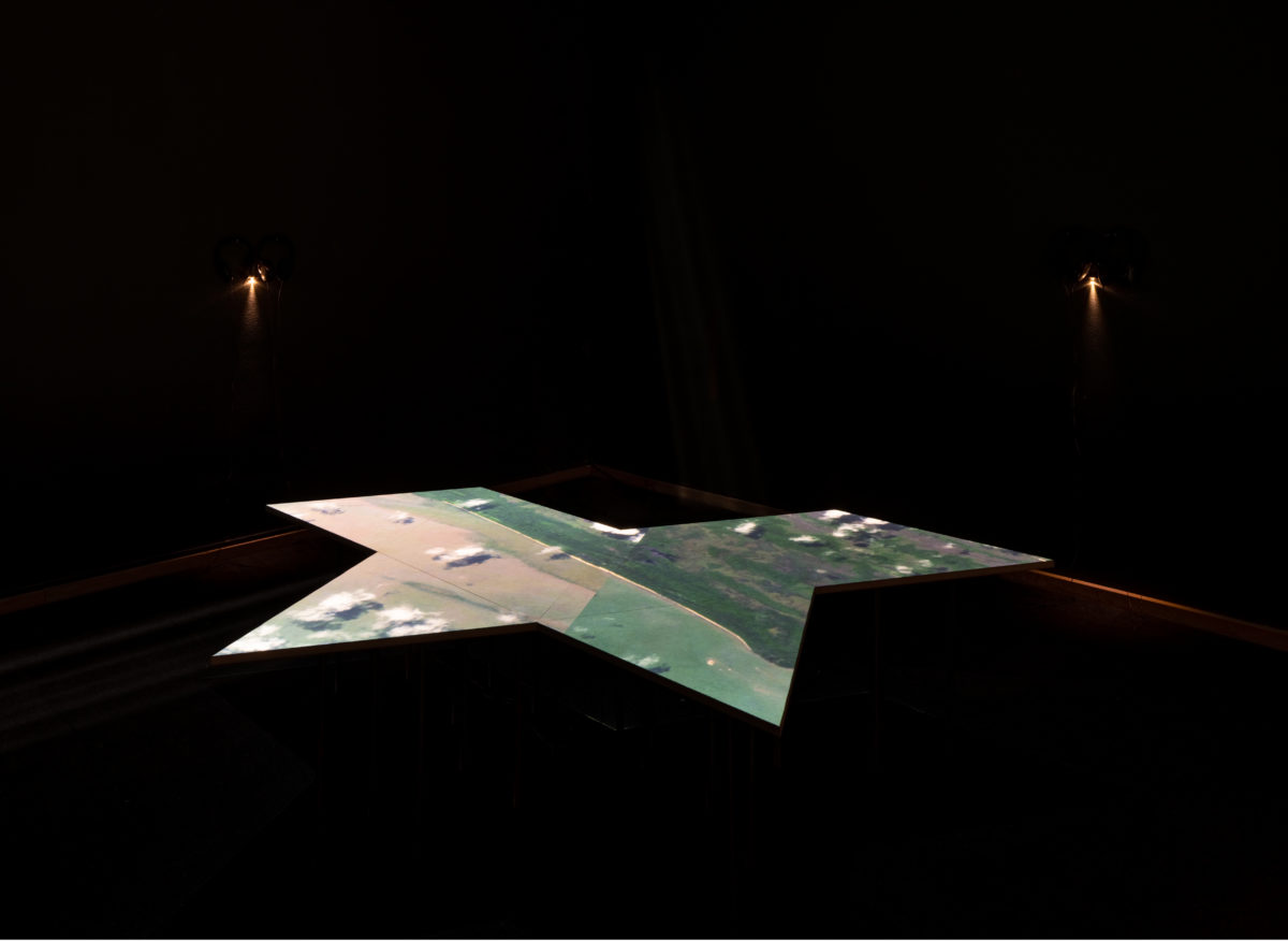
Europe’s eyes on the skin of the Earth 2021
11:40 min. Video med lyd / Video with sound Træ og metal / Wood and metal
Stemmer / Voices: Shakira Kasigwa, Sifa Dogustan and Nanna Katrine Hansen
Videomapping & teknisk / technical support: Maya SB
Tak til / Thanks to: Forrest Curriculum (AbhijanToto & Pujita Guha), Maria Cariola, Shakira Kasigwa, Monia Sander Haj-Mohamed, Jane Jin Kaisen,
Jonas Eika, Agnieszka Polska, Christian Danielewitz, Katrine Dirckinck-Holmfeld, Stephen McEvoy, Silas Emmery, David Catherall, Daniel Olivares
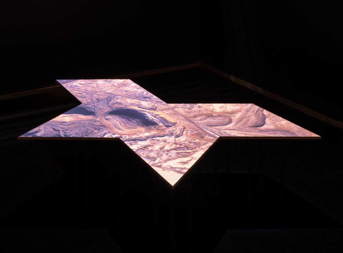
The aerial gaze of earth observation satellites is the visual material for the installation Europe’s Eyes on the Skin of the Earth unraveling a complex economic and political web that make up the fortification of the European Union’s external borders. Private security and military companies win huge contracts for supplying an array of surveillance technology such as radars, satellites and drones to the European Union. One of the biggest private security and defence companies, Airbus, is a EU’s main provider of these technologies.
Hansen has accessed the interface of satellites made by Airbus, to understand how the aerial gaze is composed, where it is constructed and who the financial benefactors are.
Hansen uses the satellites as a kind of material double-agent, and has an interest in what the satellites are made of and tracks where these materials have been extracted from and where they are brought to — familiar colonial routes reappear. Hansen also traces who is making money off European border surveillance which is an industry built up by a web of corporations, subcontractors, stakeholder and investors.
Returning to the remote sensing of the satellites themselves, they register more than what a human eye is capable of seeing, using infrared technology and other wavelengths. On the website, they showcase how aerial imagery can be used to analyse potential hiding places in bushes close to the external border of the EU as well as movements or changes within refugee campsites.
In the installation we are placed amongst the satellites, looking down on a map. Cartography is not only a tool for navigation and depiction of geographical landscapes — maps are involved in making and creating worlds.
Who are objects to be surveilled, traded, commercialized, and who can look on from the safe distance of the European fortress?
_____
Jordobservationssatellitternes blik fra oven udgør det visuelle materiale i installationen Europe’s Eyes on the Skin of the Earth, der undersøger komplekse økonomiske og politiske netværker, der udgør befæstningen af Den Europæiske Unions ydre grænser. Private sikkerheds-og militærvirksomheder vinder store kontrakter på at levere en række overvågningsteknologier såsom radar, satellitter og droner til EU. En af de største private sikkerheds- og forsvarsvirksomheder, Airbus, er blandt EU’s hovedleverandører af disse teknologier.
Hansen har fået adgang til den brugerflade, der anvendes af satellitter fra Airbus, som en del af sit arbejde for at forstå, hvordan dette blik fra oven er sammensat, hvor og hvordan det er konstrueret, og hvem der drager økonomisk fordel.
Hansen bruger satellitterne som en slags materiel dobbeltagent og har en interesse i, hvad satellitterne er lavet af. Hun sporer, hvor disse materialer er udvundet, og hvor de bringes hen – velkendte koloniale ruter op. Hansen undersøger også, hvem der tjener penge på den europæiske grænseovervågning – en industri, der består af et vidtforgrenet netværk af virksomheder, underleverandører, interessenter og investorer.
Hvad selve satellitterne angår, registrerer de mere end hvad det menneskeligt øje er i stand til at se, blandt andet ved hjælp af infrarød teknologi og andre bølgelængder. På hjemmesiden vises, hvordan luftfotografier kan bruges til at analysere potentielle skjulesteder i buske tæt på EU’s ydre grænse såvel som bevægelser eller ændringer inden for flygtningelejre.
I installationen placeres vi blandt satellitterne og ser ned på et kort. Kartografi bruges til at navigere med – og de kortlægger ikke blot geografiske landskaber; kort bruges også til at skabe og forme verdener.
Hvem anskues som objekter, der skal overvåges og kommercialiseres, og hvem kan kigge fra deres sikker afstand inde i Fort Europa?